Forecasting, Observations, and Warnings
What are Early Warning Systems?
Early warning systems (EWS) are critical life-saving tools when environmental hazards arise. Effective EWS generate, disseminate and use timely, accurate, actionable and inclusive warning information to enable individuals, communities and organizations to prepare in advance and respond appropriately to a hazard in order to reduce the possibility of harm or loss. Multi-hazard early warning systems (MHEWS) provide common capacities to prepare for and respond to several hazards, including those occurring simultaneously or cumulatively over time, and for their potential interrelated impacts. As such, MHEWS increase efficiency and consistency of warnings.
Observations
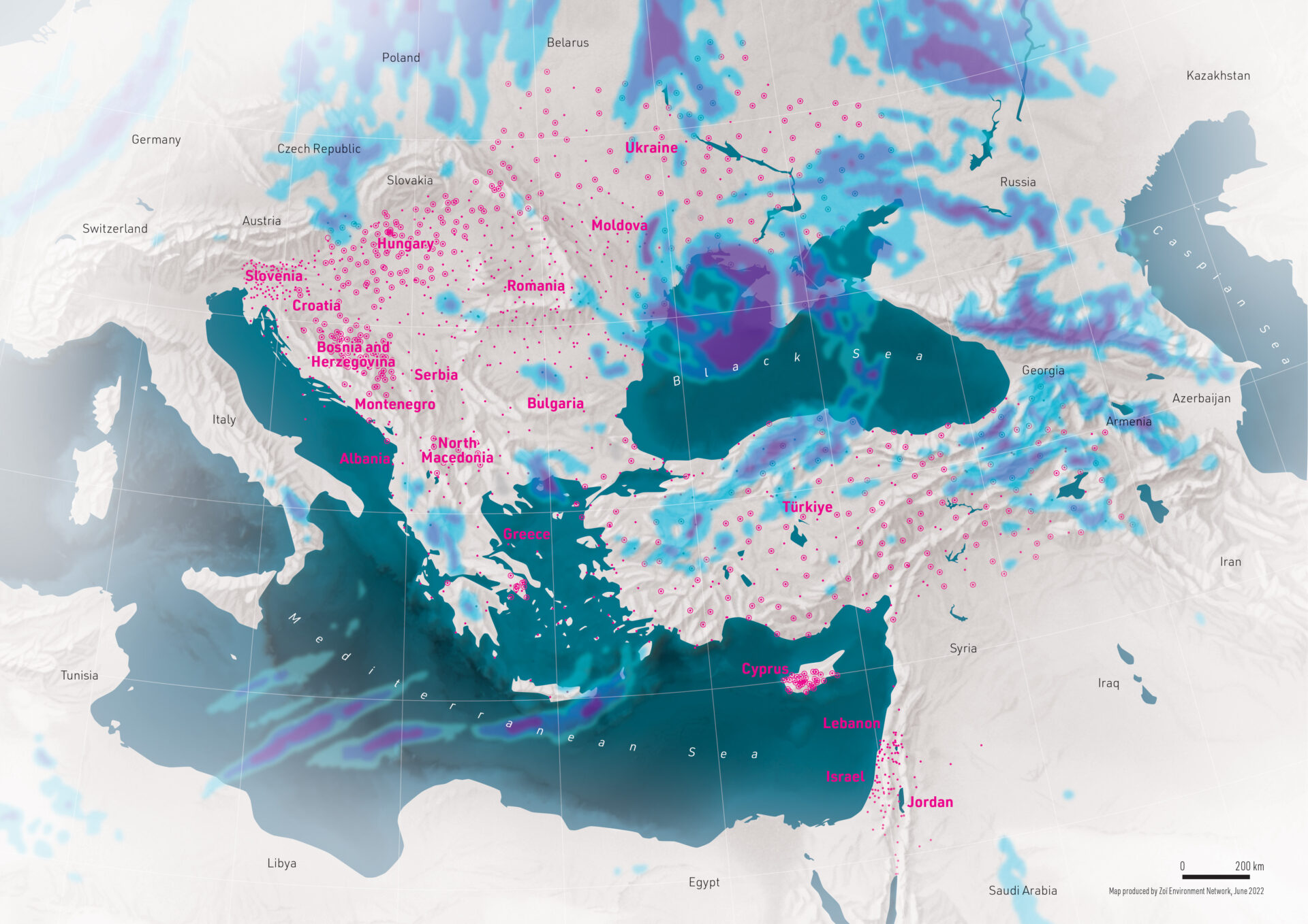
In November 2019, the project countries agreed to extend their cooperation regarding data exchange with development and signing of the Policy on the Exchange of Hydrological and Meteorological Data, Information, Forecasts and Advisories under the South-East European Multi-Hazard Early Warning Advisory System. The signatories of the Policy agreed to exchange additional observations to those they routinely share via the WMO Global Telecommunication System (GTS) to be utilized for variety of project purposes, such as numerical weather prediction data assimilation and verification, hydrological modelling, and nowcasting. Since 2020, close to 30,000 additional daily observational reports are being provided regularly by the countries to the European Centre for Medium-Range Weather Forecasts (ECMWF).
Numerical Weather Prediction
One of the main objectives of the project is to ensure timely, reliable, and accurate Numerical Weather Prediction (NWP) products and services for all project countries. Under the project activities, several high-resolution NWP models were implemented to cover an extended area around South-East Europe including parts of the Middle East. The models are run quasi-operationally at the ECMWF with outputs available for all partner countries of the project. In addition to improved weather forecasts, the outputs of these models are utilized by hydrological models implemented for the pilot river basin catchments as well as the nowcasting system.
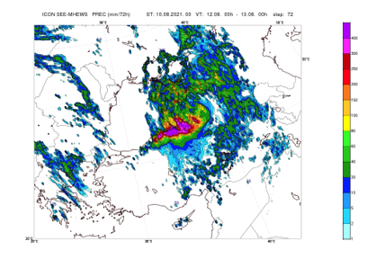
Severe rainfall in August 2021 in Türkiye forecasted by SEE-MHEWS-A ICON model
Flood Forecasting
As floods are one of the most damaging natural hazards in the region, improvement of flood forecasting has been identified as a priority in the SEE-MHEWS-A system development. During the demonstration phase of the project, hydrological models were be set up for a pilot river catchments (Vrbas River in Bosnia and Herzegovina and Vardar River in North Macedonia) to support flood forecasting and warning provision with improved lead-time. The river basins were selected as the pilot catchment based on the 'Assessment of capabilities of the SEE NMHSs in flood forecasting and warning'.
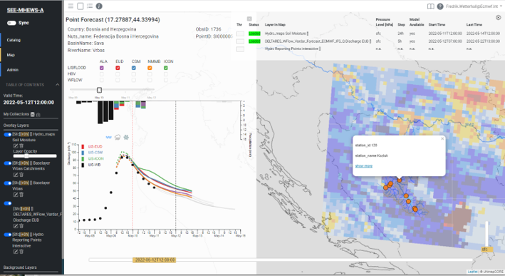
Visualization of hydrological models outputs for Vrbas River catchment in CIP
Nowcasting
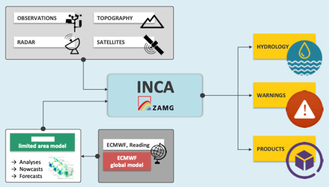
INCA Nowcasting system for SEE-MHEWS-A
Nowcasting provides very short-range weather forecasts and warnings in a timely manner and in high spatial detail. As part of the SEE MHEWS-A project, the Zentralanstalt für Meteorologie und Geodynamik (ZAMG) supported the implementation of the INCA nowcasting system for a specific area in Bosnia and Herzegovina. This provides near-real-time analyses and forecasts of several surface fields with an objective is to improve numerical forecast products in the nowcasting (0–4 h) and very short (up to about 12 h) ranges. The nowcasting module of the SEE-MHEWS-A system is planned to be extended to cover other parts of the region during the further phases of the project.
Sand and dust modelling
Modeling of dust transport and concentrations in the atmosphere is very important for contribution to risk reduction, particularly in the Middle East countries of the SEE-MHEWS-A region. The project aims to design and implement a sand and dust forecasting module during the further phases of the project.
Oceanographic and wave modelling
The oceanographic and wave modeling module of the SEE-MHEWS-A system is planned to provide the maritime countries of the project region with oceanographic products and services to support maritime safety and marine resources users.
Common Information Platform
The Common Information Platform (CIP) is the central mechanism for displaying and distribution of the products created under the SEE-MHEWS-A system to be utilized by the forecasters from the NMHSs of the project region. At the moment, CIP displays close to hundred different products, including numerical weather prediction model products, flood forecasting products derived from hydrological models, nowcasting products, and meteorological surface observations. In the future, the CIP is aimed to provide more products essential for the forecasters, including warning advisories. Furthermore, a communication mechanism is planned to be implemented so that the forecasters from different countries can jointly analyze the hazards with potential cross-border impacts.
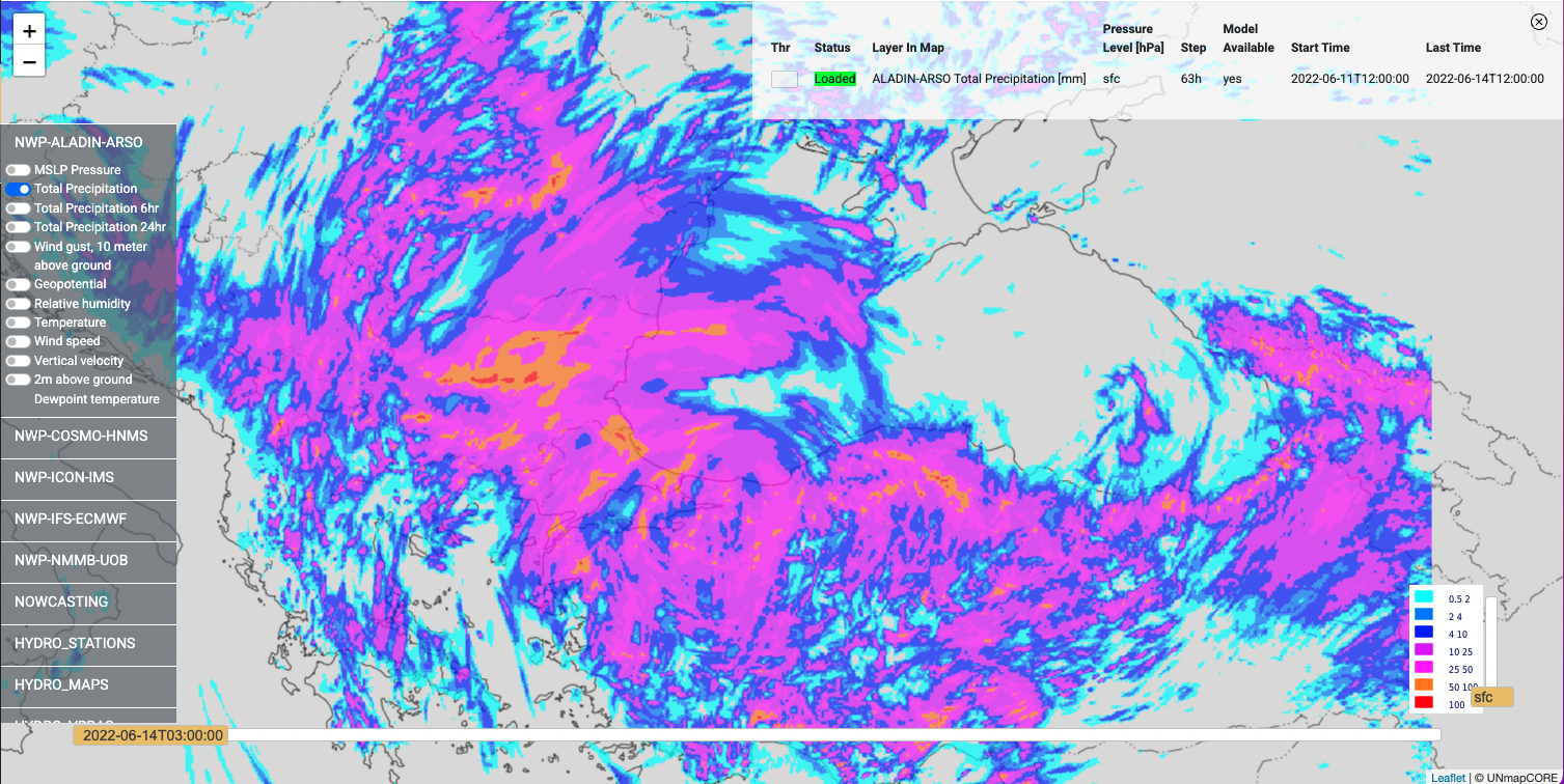
Precipitation forecast visualized in CIP


